
Initially many speculations were being made regarding the reason for the sudden flood in Nepal. Sometimes there was talk of earthquake, sometimes suspicion of Glacial Lake Outburst Flood i.e. GLOF was raised. Any incident that happened on the Chinese side was also seen in connection with this. Now when investigation was done by combining satellite images and seismic data, the story turned out to be different. A part of Lirung Glacier broke and fell down near the Nepal-Tibet border. This incident later created a dangerous wave of floods and debris. Its impact is not limited to Nepal only. This devastation is not limited to Nepal only, this mood of rapidly warming Himalayas is a big alarm bell for India also.
Actually, at the time of flood, tremors were recorded in the earth. For this reason it was initially considered an earthquake. Later the US Geological Survey i.e. USGS re-examined this record. The agency said that there was no earthquake there. The vibration that was recorded was caused by the breaking of the glacier and the debris that came down with it. That is, what was earlier thought to be the cause of the flood was actually the effect of the same incident.
Glacier broke, debris came down again
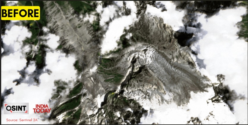
Nepal-A large part of the glacier broke near the Tibet border and fell into the valley about a kilometer below. Snow, stones and debris also came down with it. Satellite photos showed a new trail from the glacier to the valley. This was the same place from where the record of vibration was found.
Now understand it like this. A large part of snow was accumulated on the mountain. When water reached below it, the grip between the snow and the ground became weak. Then part of the glacier slipped and fell down.
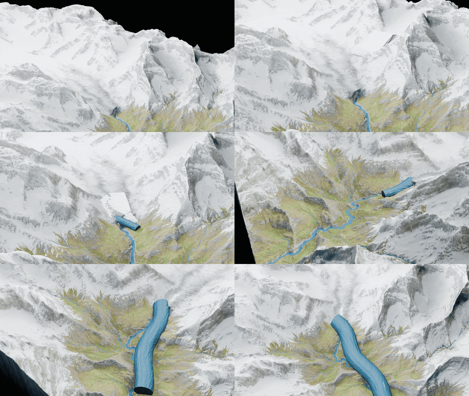
During this time heavy debris reached the river. Due to this the course of the river was affected and the water moved rapidly downwards.
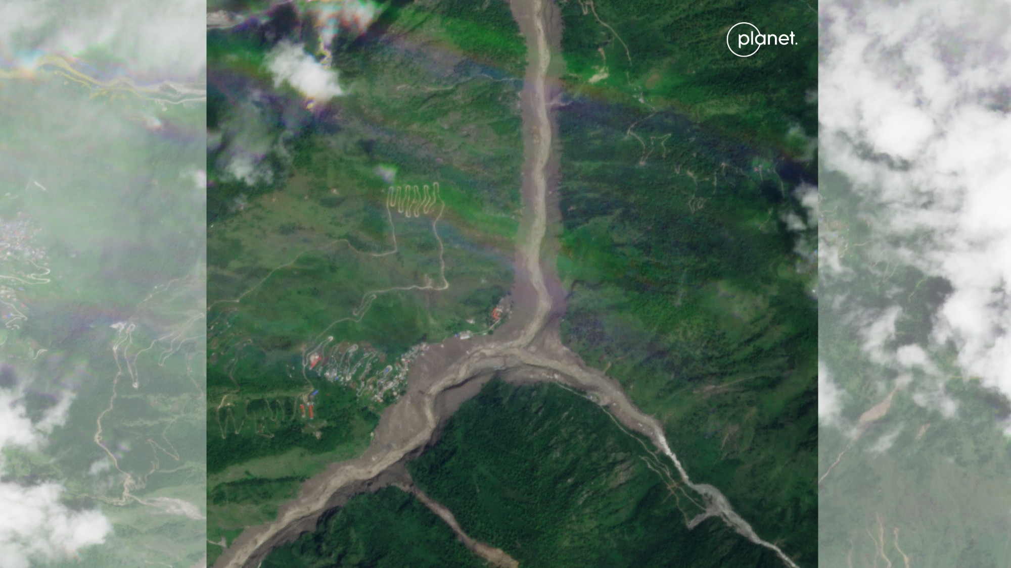
The river changed its form in a short time
The strength of the flood can be gauged from the fact that the river spread manifold within no time. Riverside settlements in Syafrubesi were buried under heavy debris. The depth of the river in Betravati Bazaar increased from 90 meters to 490 meters. The situation was similar in Bidur too, where the river spread from 100 meters to 549 meters wide and the edge of the city came under its grip. The river which was flowing normally till some time ago, soon increased its course manifold. That is, the river on the banks of which people were living a normal life, spread manifold in a short time.
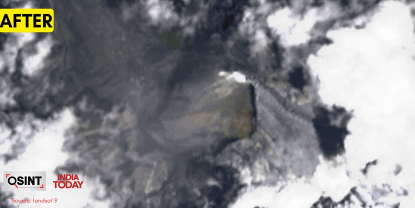
The real worry starts now
After the breakage of the glacier came to light, the next question is why did it break? Scientists are investigating the reasons behind this like melting of ice, increase in temperature and water reaching inside the glacier. It is too early to consider this as a direct result of climate change, but the changing temperatures and rapid melting of snow in the Himalayas have definitely increased the danger. According to scientists, when the melted water reaches inside the glacier, slipping between the ice and the ground can increase. In such a situation, any part of the glacier may suddenly break.
Another flood threat?
The danger does not end with that flood alone. Nepal-China Debris is still accumulated in the upper areas of the border, which may block the path of water. Qianggong Zhang, Climate and Environmental Risks Lead at the International Center for Integrated Mountain Development (ICIMOD), has warned that if these barriers are suddenly broken, there could be strong floods again downstream.
This incident in Nepal has explained a simple thing. In the Himalayas, ice, water, rock and weather are interconnected. Even a seemingly small incident in the mountains can cause major devastation in the areas below. Amid rising temperatures from Tibet to India Such dangers may extend to the hilly areas. Therefore, it is important to monitor glaciers, give timely warnings and keep an eye on river routes.
—- End —-
Source link
[ad_3]

