
More than 200 people have been confirmed dead in the floods that occurred on the Nepal-Tibet border on August 26. About 1,500 people are still missing. It is being claimed that many lives could have been saved if China had warned on time.
.
So is China really responsible for the horrific devastation in Nepal? Today’s explainer will be on what is the system of warning of disasters between the two countries…
Question-1: What are the allegations against China behind the floods in Nepal?
answer: Nepali journalist Parshuram Kafle wrote on X, ‘China did not fulfill its responsibility. If Beijing’s disaster detection system had provided early warning, more lives could have been saved in Nepal. Nepal always takes care of China’s concerns. There is a price to be paid for this one-sided love.
According to the Meteorological Department of Nepal, there is an arrangement to share weather related information between Nepal and China, but no information was given in advance about this incident.
Vibhuti Pokharel, senior scientist of Nepal’s Meteorological Department, says, ‘We are in touch with Chinese officials, but till now they have not been able to tell what is the reason for the flood.’
In 2016 also, there was a severe flood in Rasuwagadhi area on the Nepal-Tibet border. Even then experts had said that if information had been shared between the two countries in time, the loss could have been reduced.
The Rasuwagadhi-Gyirong cross-border land port connecting Nepal and China was damaged due to the flood. Flood is seen coming over Tibet’s Immigration Complex.
Question-2: Is there a rule to give information about such accidents between the two countries or not?
answer: It was decided between Nepal and China to share information related to weather and disasters, but no formal agreement has been reached on this.
In fact, on July 8, 2025, a glacier lake named ‘Purepu’ burst in the mountains of Tibet in the Chinese territory, 35 kilometers above Rasuwagadhi border point. Due to this, flood debris reached an area of about 100 km around Bhotekoshi river. More than a dozen people had died.
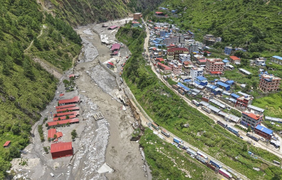
Last year, 9 people died in the flood on Bhotekoshi river. Many hydropower projects were damaged.
After this, Nepal and China had decided on three things…
- Both the countries will share real-time information related to floods etc. between themselves.
- An early warning system will be created for this.
- If there is a danger of glacier lake bursting in the mountains, i.e. ‘Glacial Outburst Flood, GLOF, then that will also be flagged.
Sudeep Thakur, Professor of Environment Studies at Nepal’s Tribhuvan University, says, ‘There is a system to collect weather related information in Tibet, but it is not shared with Nepal. There is no problem in giving scientific information to China, but perhaps the Nepal government has not been able to put forward its demands firmly to them.
Vasant Adhikari, director of Nepal’s Disaster Study Center, also says that till now there is no system to share information.
Question-3: What has China said on the allegation of not sharing information?
answer: China has not given any direct reply to this, although the Chinese Embassy has said in its statement that the earthquake has caused floods and this earthquake came towards Nepal.
The statement said, ‘China is deeply saddened by the floods in the Rasuwa-Gyirong border area. The earthquake that hit Nepal caused avalanches and then debris flows. This led to the death of people on both sides of the border.
Actually, earlier it was said that the ice glacier broke due to an earthquake of about 5 magnitude on the Richter scale, however later the US Geological Survey made it clear that the earthquake-like shock was caused by the breaking of ice and rock.
However, the Chinese Embassy has definitely said, ‘In the future, we will work better to share information related to weather and disasters across the border.’
Question-4: Did the snow mountain fall in China or Nepal?
answer: According to Nepal’s disaster management authority, NDRRMA, the location of the glacier break is about 20 kilometers north-east of the Nepal-China border post. According to Prakash Pokharel, scientist of the authority, ‘This area falls on the Nepali side, and not on the Chinese side.’
However, Nepalese meteorologist Vibhuti Pokharel says, ‘We are in touch with Chinese officials, but it is not yet known whether the incident happened in Nepal or on the Chinese side.’
Actually, due to monsoon season there are a lot of clouds in that area. Therefore, it is not clear from satellite images what is the exact location of glacier breakage.
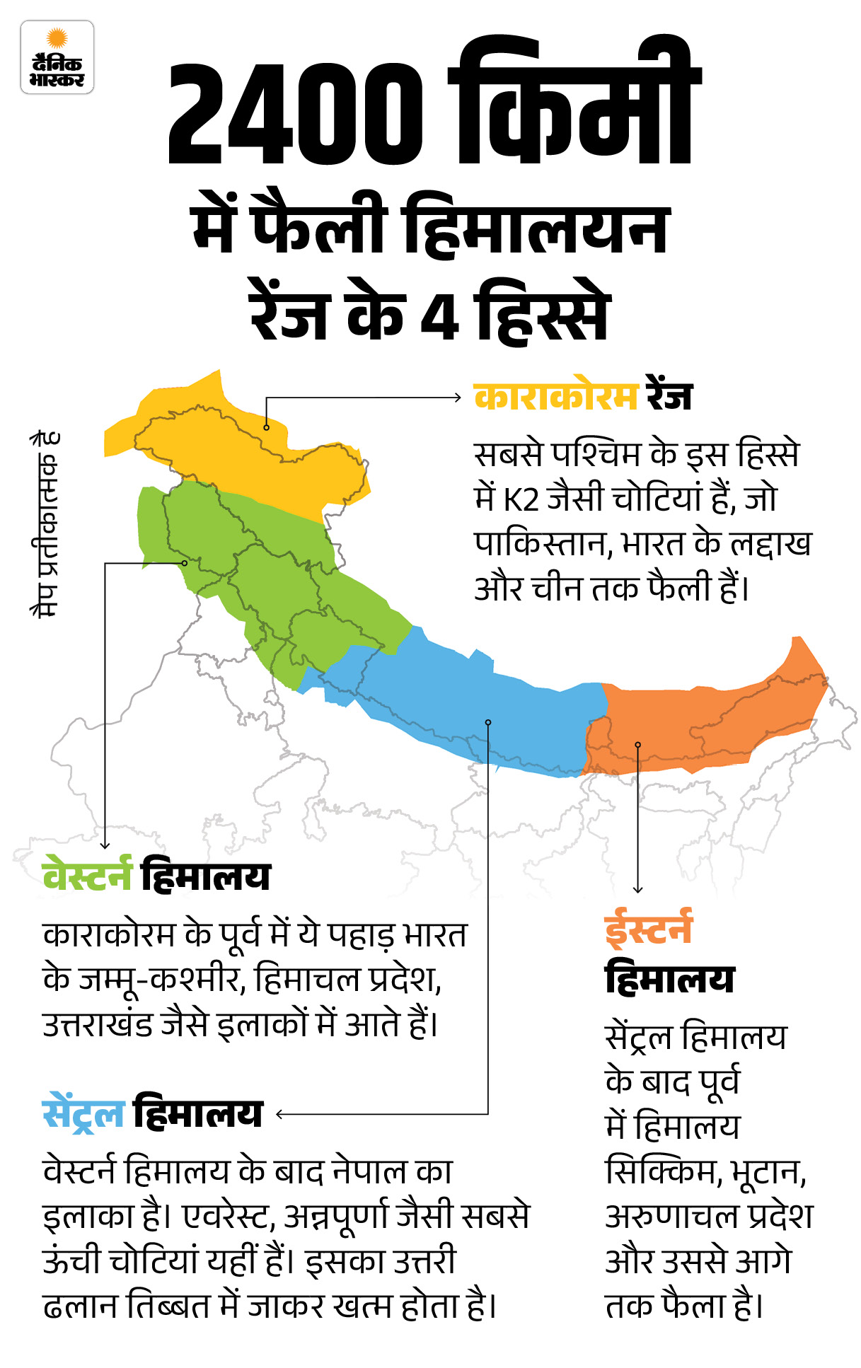
Roughly, the area where the glacier broke is on the crestline of the Central Himalayan Range. That is, if the slope of one side of the mountain is in Nepal, then the slope of the other side of the same mountain is in Tibet, which is under the control of China. Snow and glaciers accumulate at an altitude of about 8000 meters, which melt and become a source of water for the rivers on both sides.
Technically, if a glacier breaks at high altitude, it can affect the rivers of both the countries below.
The Poiku River originates from a glacier in Tibet. Then it crosses the border and enters Nepal and there it is called Bhotekoshi, its tributary river Lhende was flooded.
There is one more thing – according to China, first there was an earthquake and then the glacier broke. Whereas meteorologists around the world including Nepal believe that the glacier broke first, due to which an earthquake-like shock was felt.
Question-5: How did the breaking of the glacier cause such a terrible devastation in Nepal? Answer: Understand the whole incident in 3 steps….
1. Glacier broke: On the morning of 26 August, about 2000 feet of glacier broke at a height of about 17 thousand feet and fell down 4 thousand feet.
2: Water accumulated in the river: At around 8:37 am, the melted glacier hit the Lhende river carrying with it rocks and debris. Due to this, a temporary dam was formed on the Lhende river and water started accumulating behind it.
3. Flood swept away due to breaking of river dam: At around 9 in the morning, due to the increasing water pressure, the dam of the river broke, creating a huge flood and flowing towards the low-lying areas. Further, there was debris flood in Bhote Koshi and Trishuli rivers.
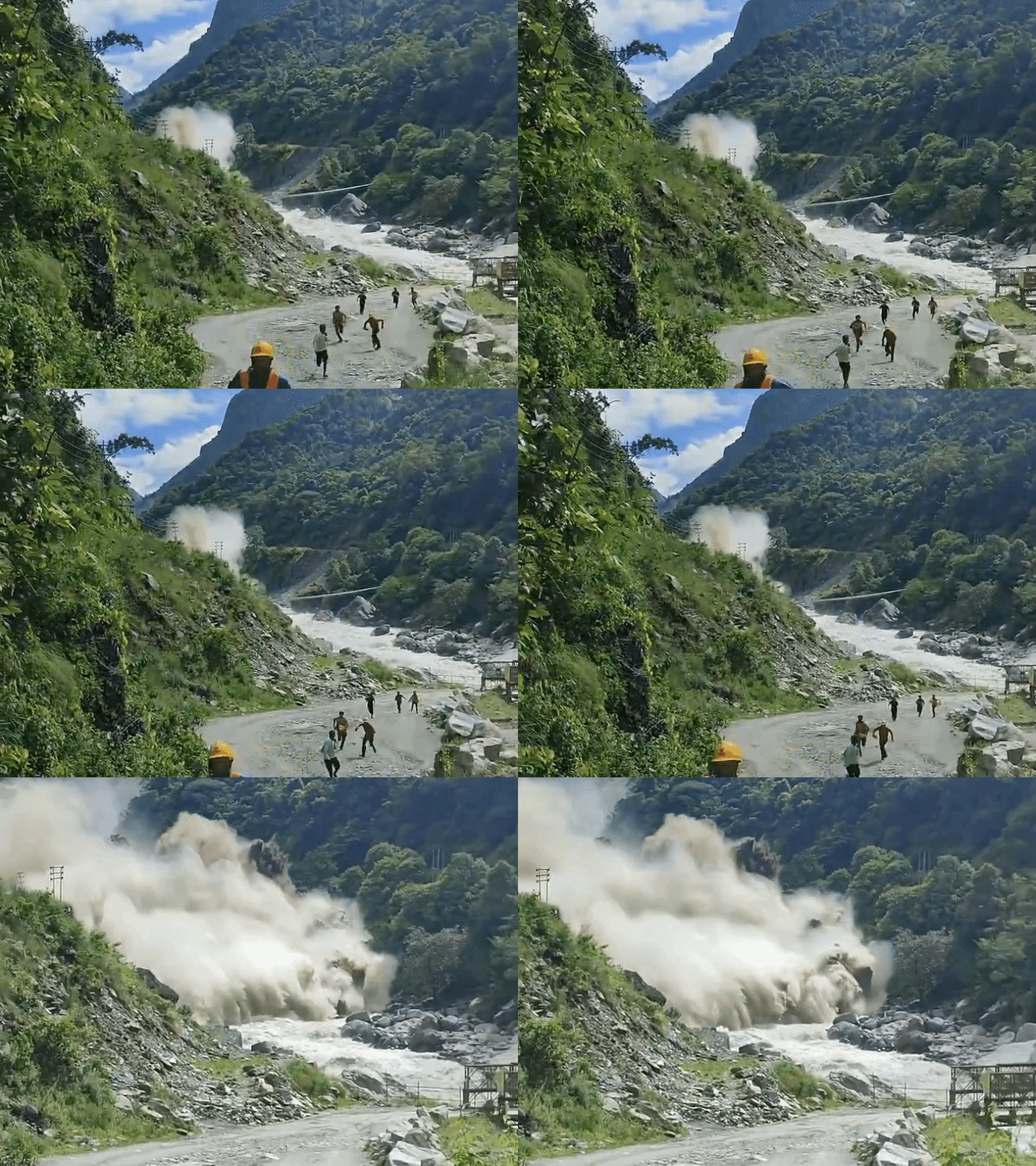
Due to flash flood, waves of water were rising up to 30 feet. 175 people have died and more than 1500 are missing.
There was catastrophic flood impact from Nepal’s Rasuwa to Chitwan via Nuwakot, Dhading. About a dozen settlements in Rasuwa were affected. The floods reached Galchi in Dhading district and were warned of moving further towards Mughalin.
The danger is not over yet. Scientists say that there is still a debris blockage in the river near the Nepal-China border, which can break at any time and release another wave of flood.
The Trishuli river in which this flood occurred further meets the Narayani river. It reaches Bihar, India, where it is called Gandak River. Areas of Bihar and UP have also been kept on high alert.
———
Watch this video also…
2000 feet wide glacier broke, the earth started trembling without earthquake: Watch each scene of Nepal’s devastation from beginning to end.
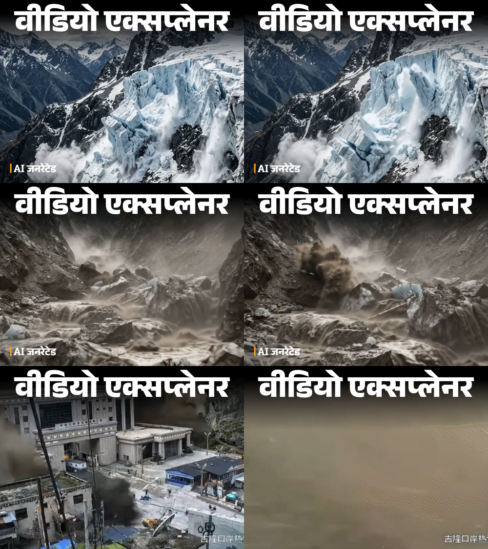
26 August, 8:30 am. The weather was clear on the Nepal-Tibet border. No one had any idea what was going to happen in the next 30 minutes. Every scene of Nepal’s destruction from beginning to end, Watch the video…
Source link
[ad_3]

